Sale on canvas prints! Use code ABCXYZ at checkout for a special discount!


by Texas Map Store
$45.00
Design Location
Color
Image Size
Product Details
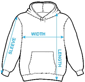
Our hoodies are made from a 75% cotton / 25% polyester blend and are available in five different sizes. All hoodies are machine washable.
Design Details
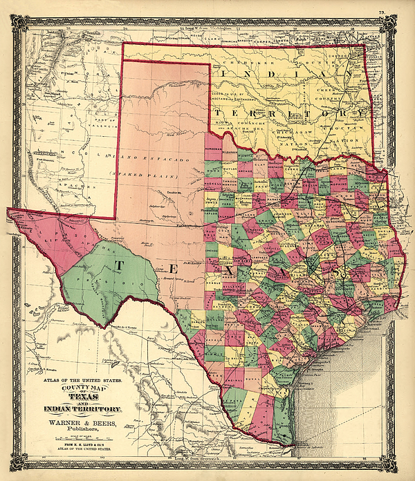
This beautiful hand-colored map is by Warner & Beers from H.H. Lloyd & Co.'s Atlas of the United States shows counties, principle cities, railroads,... more
Ships Within
1 - 2 business days
This beautiful hand-colored map is by Warner & Beers from H.H. Lloyd & Co.'s Atlas of the United States shows counties, principle cities, railroads, relief by hachures and rivers. Oklahoma was still "Indian Territory" and major tribal areas are shown.
$45.00


There are no comments for Texas and Indian Territory 1875. Click here to post the first comment.