Sale on canvas prints! Use code ABCXYZ at checkout for a special discount!

Boundary: Bleed area may not be visible.


by Texas Map Store
$60.00
Size
Orientation
Image Size
Product Details
Our premium yoga mats are 24" wide x 72" tall x 0.25" thick and made from natural rubber with a blended microfiber top surface. The top of the mat has the image printed on it, and the back is solid black with textured dimples for better floor grip.
Design Details
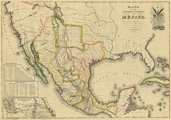
This map, in Spanish, covers the entirety of Mexico as it was in 1828 including what is now Texas, New Mexico, and California. It shows rivers,... more
Care Instructions
Wash with a damp cloth and air dry.
Ships Within
2 - 3 business days
This map, in Spanish, covers the entirety of Mexico as it was in 1828 including what is now Texas, New Mexico, and California. It shows rivers, lakes, mountainous areas, mines, cities, towns, missions, forts, and Indian tribes, ruins, and villages. It features an inset map, 'Carta de los Caminos & c. desde Vera Cruz y Alvardo a Mejico (Map of the Roads and etc. from Vera Cruz and Alvardo to Mexico City)' as well as two tables: 1) Tabla de Distancias, 2) Tabla Estadistica (Statistics).
$60.00


There are no comments for Mapa de los Estados Unidos de Mejico 1828. Click here to post the first comment.