Sale on canvas prints! Use code ABCXYZ at checkout for a special discount!

Boundary: Bleed area may not be visible.


by Texas Map Store
$70.00
This product is currently out of stock.
Image Size
Product Details
Here it is... the towel that's taking the internet by storm. Our round beach towels are 60" in diameter and made from ultra-soft plush microfiber with a 100% cotton back. Perfect for a day at the beach, a picnic, an outdoor music festival, or just general home decor. This versatile summer essential is a must-have this season!
Design Details
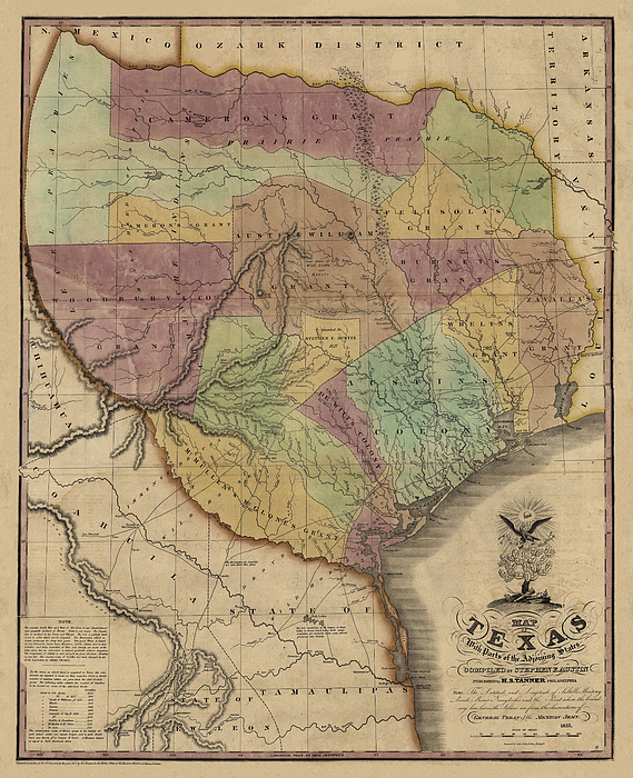
In 1829, after spending six years exploring Texas and gleaning information from travelers and surveyors, Stephen F. Austin sent the information to... more
Dimensions
60" Diameter Not Including Tassles
Care Instructions
Machine wash cold and tumble dry with low heat.
Ships Within
2 - 3 business days
In 1829, after spending six years exploring Texas and gleaning information from travelers and surveyors, Stephen F. Austin sent the information to Henry S. Tanner, a prominent Philadelphia publisher, who used it to created a forerunner of this map in 1830. This 1837 edition was regarded as the most accurate of the day and was copied by many other publishers and cartographers.
$70.00


There are no comments for Map of Texas with Parts of Adjoining States by Stephen F. Austin, 1837. Click here to post the first comment.